Caracas Pictures, Images and Stock Photos
Browse 5,200+ caracas stock photos and images available, or search for caracas venezuela or caracas map to find more great stock photos and pictures.
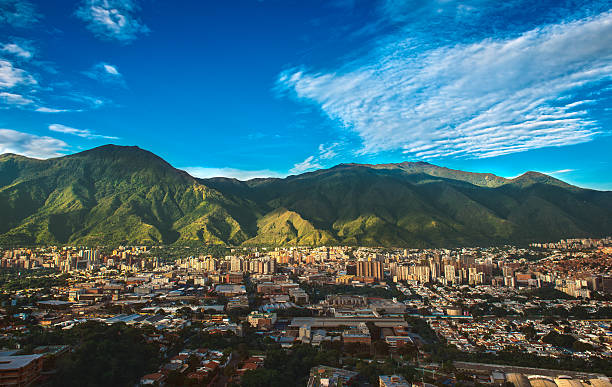
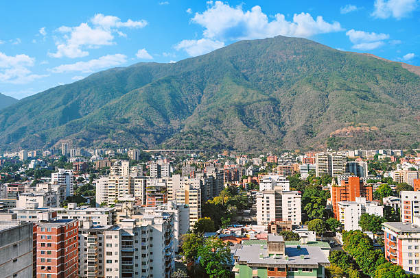
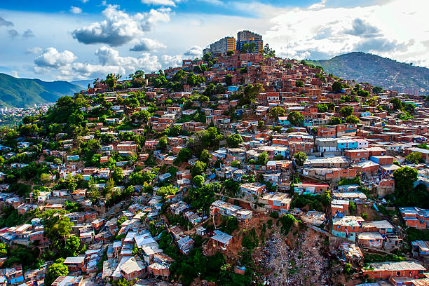
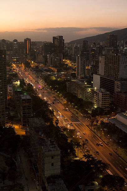
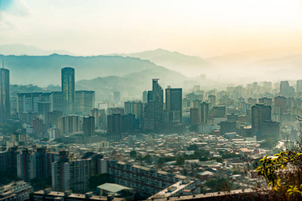
Photograph of Caracas, a Venezuelan city under siege from organized crime and corruption, shot during a beautiful sunny November afternoon displaying the vibrant contrast between the inherent beauty of the city (as shown from a far wide angle shot) and the internal dangers of its daily life.
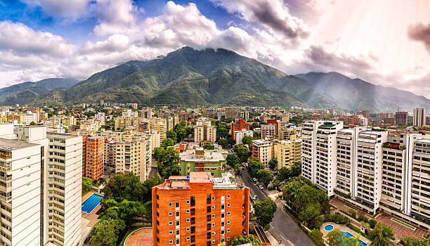
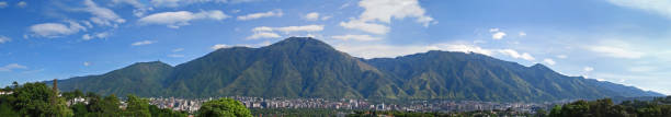
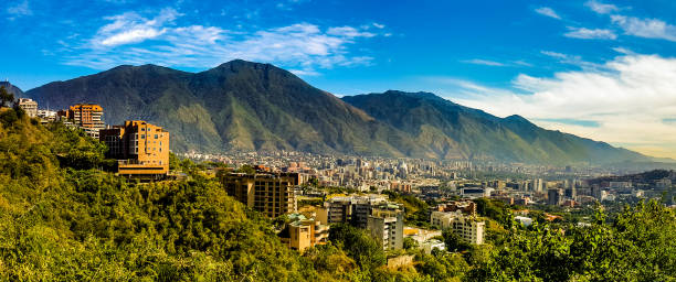
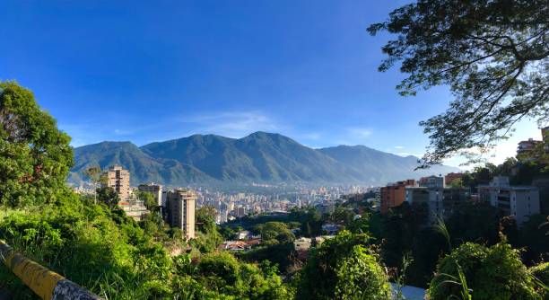
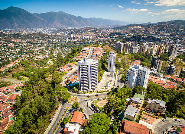
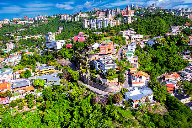
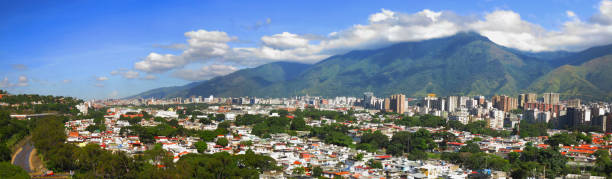
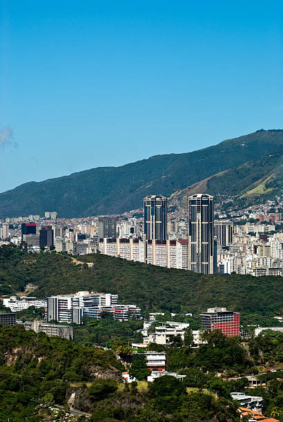
Eastern Caracas panoramic city view at Chacao Municipality. Image taken at mid afternoon with Avila mountain in the background.Cerro El Avila en el Municipio Chacao.

the cityscape at the Caracas Airport at the coast of Caracas in the north of Venezuela.
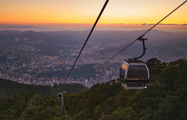
Modular cabins cable car against the bright sky, clouds ans mountains. Waraira Repano National Park at 1020 meters above sea level in Caracas Venezuela.

Wide angle of Caracas skyline, Venezuela
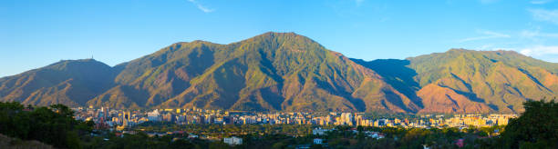
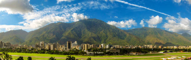
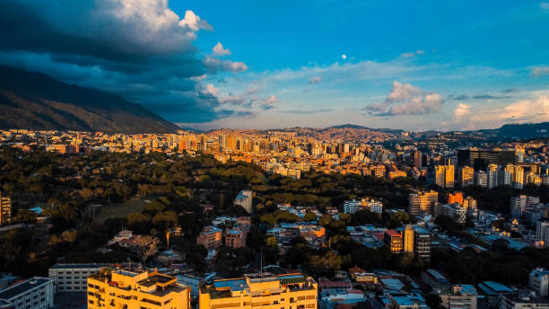
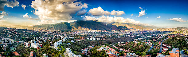
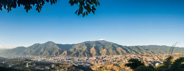
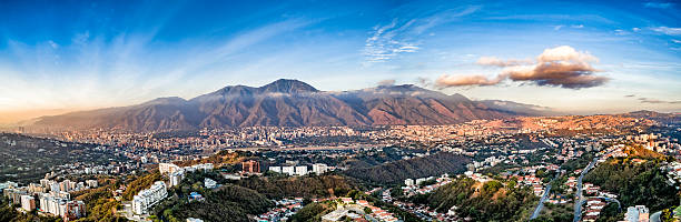
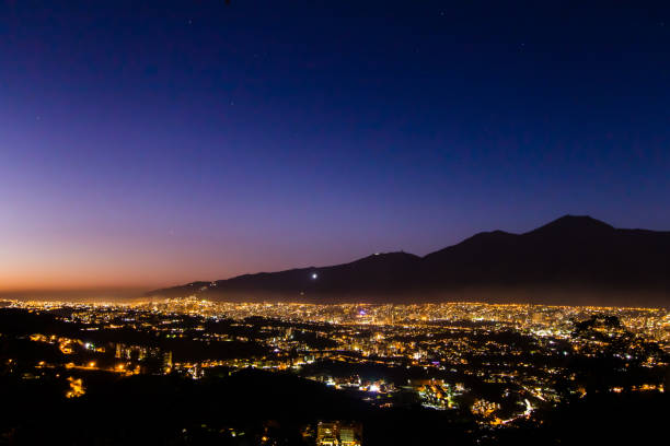
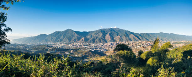
Panoramic image of eastern Caracas city aerial view at late afternoon. Venezuela. Showing El Avila mountain.
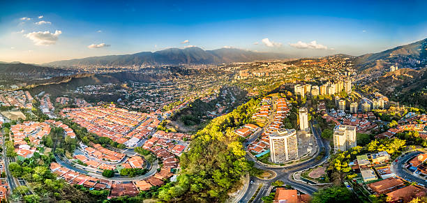
Panoramic image of eastern Caracas city aerial view at late afternoon. Venezuela. Showing El Avila mountain also known as El Avila National Park (Guaraira Repano). Santiago de Leon de Caracas, is the capital city of Venezuela and center of the Greater Caracas Area. It is located in the northern part of the country, following the contours of the narrow Caracas Valley and the "Cordillera de la Costa". The valley is close to the Caribbean Sea, separated from the coast by a steep 2,200 m (7,200 ft) high mountain range, Cerro El Avila. To the south there are many more hills and mountains with residential constructions. Caracas is divided into five municipalities: Libertador, Chacao, Baruta, Sucre, and El Hatillo. Libertador holds many of the government buildings and is the Capital District (Distrito Capital). The Metropolitan Region of Caracas has an estimated population of 5,250.000.

Caracas, Venezuela - December 31, 2018. The Soto Sphere (La Esfera de Soto) is kinetic art sculpture by the Venezuelan plastic artist Jesús Soto, inaugurated in 1997. It is part of a government program called Un Cariño para mi Ciudad. It is located on the southern slope of the Santa Cecilia distributor of the Francisco Fajardo highway. The Soto Sphere also known as The Caracas Sphere is one of the cultural icons of the capital of Venezuela.
A view of the city of Caracas - Venezuela with the view of the Avila mountain range in the backdrop
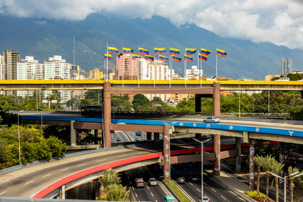
Multi level highway in center of Caracas capital Venezuela with national flags at day
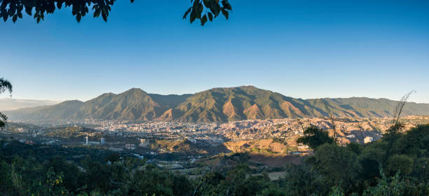
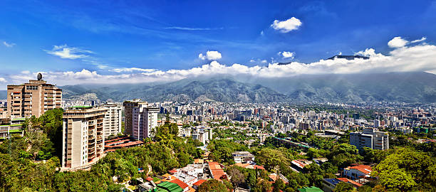
Caracas panoramic on a sunny day, you can see the Avila Mountain and the city at its foot as well as the surrounding hills
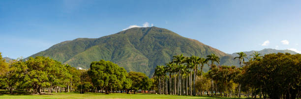
Panorama view of The El Ávila National Park (or Waraira Repano, from an indigenous name for the area), in Caracas, Venezuelan Capital.
The Image was take In Caracas, Venezuela. Was Create on November, 18, 2017, In the image it is Caracas City and The Mountain called 'Cerro El Avila" , And its Happening a Clear Sky Day in the City.
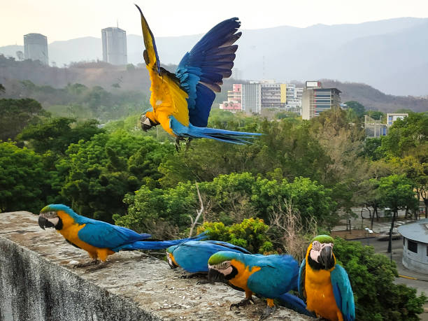
Macaws have become an icon in the City of Caracas since they were introduced about 30 years ago. Every day they fly free in Caracas and thousands of people feed and care for them, but always free.
Picture took on September 29, 2012 , done with 5 files merged and edited in July 2, 2018 , its a landscape of Caracas City.
A view of the city of Caracas - Venezuela with the view of the Avila mountain range in the backdrop
A view of the Avila mountain range in Caracas - Venezuela with the city of Caracas in the foreground. The Avila mountains are considered an extension of the Andes, being its last segment of its northern extreme.
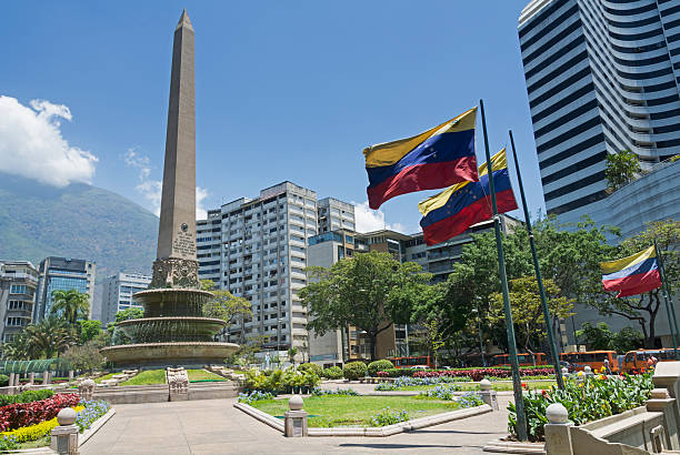
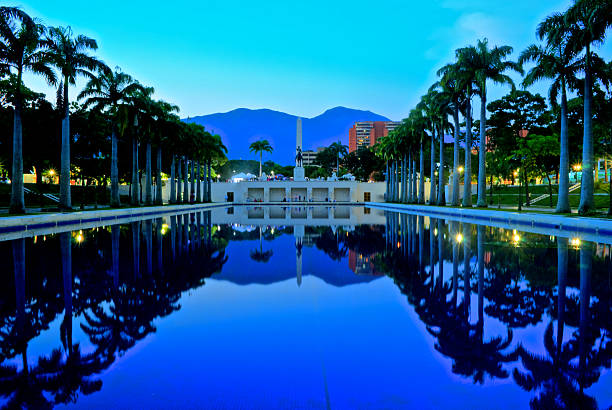
Caracas, Venezuela - March 25, 2016: Plaza Francia (France Square), also known as "Plaza Altamira", is a public space located in Altamira, east Caracas. It was built at the beginning of the decade 1940s and opened in August 11, 1945 with the original name of "Plaza Altamira", later its name changed due to an agreement between the cities of Caracas and Paris to have a Venezuela Square in Paris and a France Square in Caracas. This square was designed by town planner Luis Roche within the project of "Altamira neighborhood", a wealthy district of Chacao municipality in Miranda States.
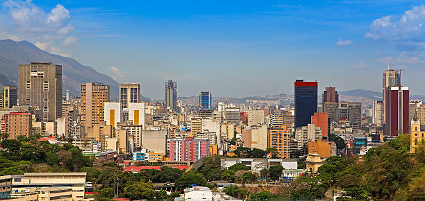
Skyline of downtown Caracas, capital and largest city of Venezuela
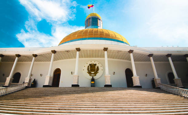
The Capitol Building, National Assembly of Venezuela in Caracas
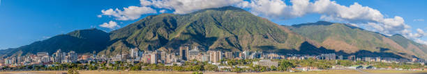
Cityscape of Caracas, Venezuela, with Avila mountain in the background in a Sunny beautiful day.
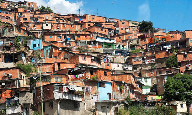
Slum zone in Caracas city, Venezuela capital
![Light at the end of tunnel? Social Issues: Architectural Chaos in poverty zones, Caracas, Venezuela.
Other Links:
[url=file_closeup.php?id=5291102][img]file_thumbview_approve.php?size=1&id=5291102[/img][/url] [url=file_closeup.php?id=5290975][img]file_thumbview_approve.php?size=1&id=5290975[/img][/url] [url=file_closeup.php?id=5290974][img]file_thumbview_approve.php?size=1&id=5290974[/img][/url] [url=file_closeup.php?id=5291132][img]file_thumbview_approve.php?size=1&id=5291132[/img][/url] [url=file_closeup.php?id=5323995][img]file_thumbview_approve.php?size=1&id=5323995[/img][/url]
Check out more of my [u][b][url=file_search.php?text=social&issues,%20shanty,&action=file&filetypeID=1&username=apomares]Social Issues[/url][/b][/u] images caracas stock pictures, royalty-free photos & images](https://media.istockphoto.com/id/108195369/photo/light-at-the-end-of-tunnel.jpg?s=612x612&w=0&k=20&c=4T_TvvnVxdkXYesfJ62poSrXVodjaIow3C48KwpXFFs=)
Social Issues: Architectural Chaos in poverty zones, Caracas, Venezuela. Other Links: [url=file_closeup.php?id=5291102][img]file_thumbview_approve.php?size=1&id=5291102[/img][/url] [url=file_closeup.php?id=5290975][img]file_thumbview_approve.php?size=1&id=5290975[/img][/url] [url=file_closeup.php?id=5290974][img]file_thumbview_approve.php?size=1&id=5290974[/img][/url] [url=file_closeup.php?id=5291132][img]file_thumbview_approve.php?size=1&id=5291132[/img][/url] [url=file_closeup.php?id=5323995][img]file_thumbview_approve.php?size=1&id=5323995[/img][/url] Check out more of my [u][b][url=file_search.php?text=social&issues,%20shanty,&action=file&filetypeID=1&username=apomares]Social Issues[/url][/b][/u] images
Caracas city, Venezuela
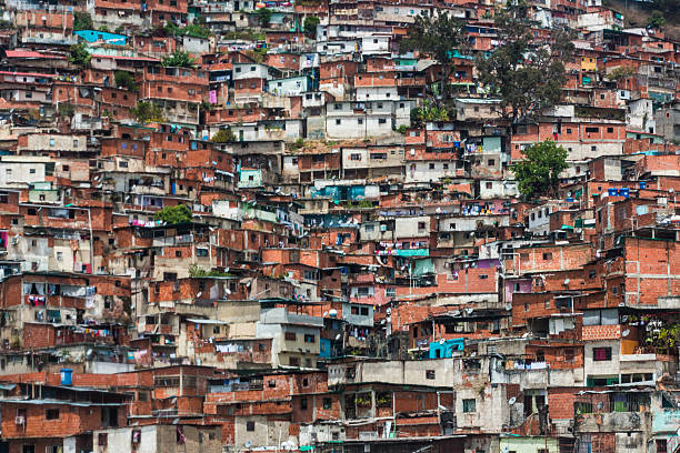
Barrio in Caracas, Venezuela
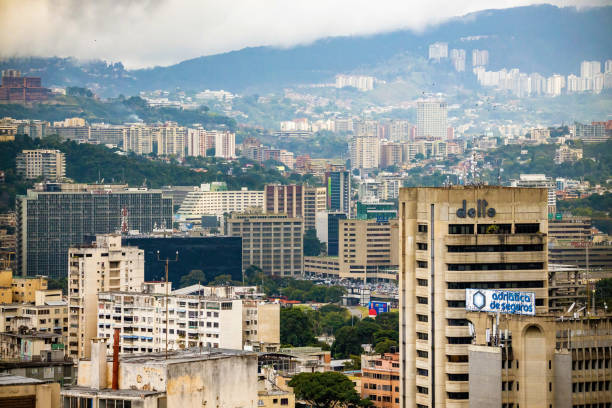
Skyline and Buildings of Caracas, Venezuela
Valle de Caracas, capital de Venezuela, al atardecer.
South Eastern Caracas city aerial El Avila at the background at late afternoon. Venezuela. Showing El Avila mountain also known as El Avila National Park (Guaraira Repano). Santiago de Leon de Caracas, is the capital city of Venezuela and center of the Greater Caracas Area. It is located in the northern part of the country, following the contours of the narrow Caracas Valley and the "Cordillera de la Costa". The valley is close to the Caribbean Sea, separated from the coast by a steep 2,200 m (7,200 ft) high mountain range, Cerro El Avila. To the south there are many more hills and mountains with residential constructions. Caracas is divided into five municipalities: Libertador, Chacao, Baruta, Sucre, and El Hatillo. Libertador holds many of the government buildings and is the Capital District (Distrito Capital). The Metropolitan Region of Caracas has an estimated population of 5,250.000.
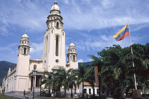
Panteón Nacional or National Cemetery and historical monuments near Caracas Venezuela including burial place of Simon Bolivar
Panoramic image of eastern Caracas city aerial view at late afternoon. Venezuela. Showing El Avila mountain also known as El Avila National Park (Guaraira Repano). Santiago de Leon de Caracas, is the capital city of Venezuela and center of the Greater Caracas Area. It is located in the northern part of the country, following the contours of the narrow Caracas Valley and the "Cordillera de la Costa". The valley is close to the Caribbean Sea, separated from the coast by a steep 2,200 m (7,200 ft) high mountain range, Cerro El Avila. To the south there are many more hills and mountains with residential constructions. Caracas is divided into five municipalities: Libertador, Chacao, Baruta, Sucre, and El Hatillo. Libertador holds many of the government buildings and is the Capital District (Distrito Capital). The Metropolitan Region of Caracas has an estimated population of 5,250.000.
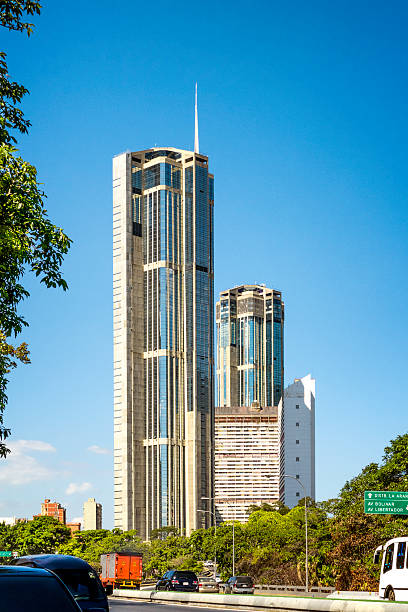
Parque Central government office and residential buildings, Caracas, Venezuela
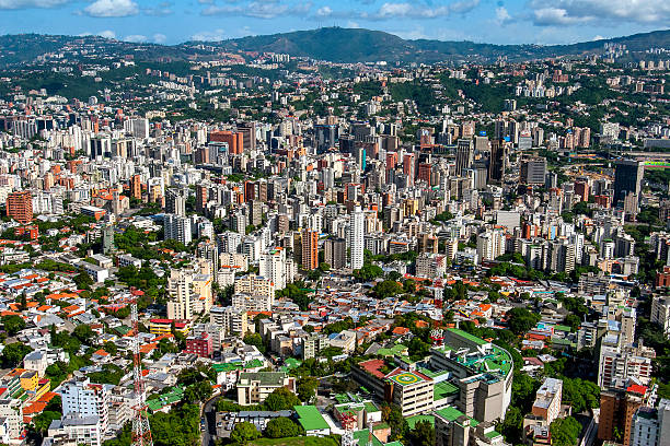
Caracas, Venezuela - 11-17-2021: Panoramic view of the Caracas city center modern buildings at day
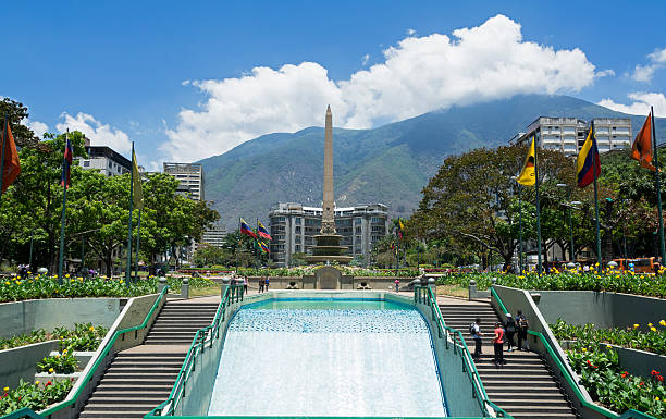
Caracas, Venezuela - March 25, 2016: Plaza Francia (France Square), also known as "Plaza Altamira", is a public space located in Altamira, east Caracas. It was built at the beginning of the decade 1940s and opened in August 11, 1945 with the original name of "Plaza Altamira", later its name changed due to an agreement between the cities of Caracas and Paris to have a Venezuela Square in Paris and a France Square in Caracas. This square was designed by town planner Luis Roche within the project of "Altamira neighborhood", a wealthy district of Chacao municipality in Miranda States.

Caracas city, Venezuela capital, South America
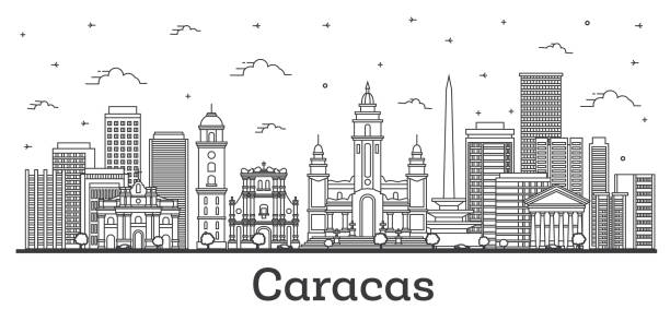
Outline Caracas Venezuela City Skyline with Modern and Historic Buildings Isolated on White. Vector Illustration. Caracas Cityscape with Landmarks.
Caracas panoramic on a sunny day, you can see the Avila Mountain and the city at its foot as well as the surrounding hills
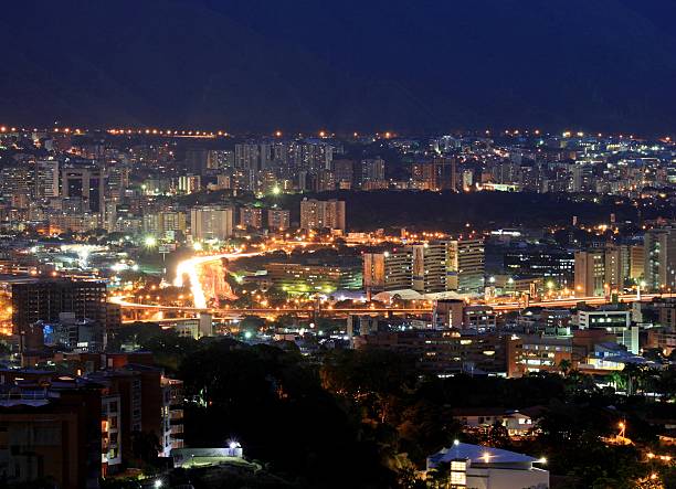
the city of Caracas on a busy night
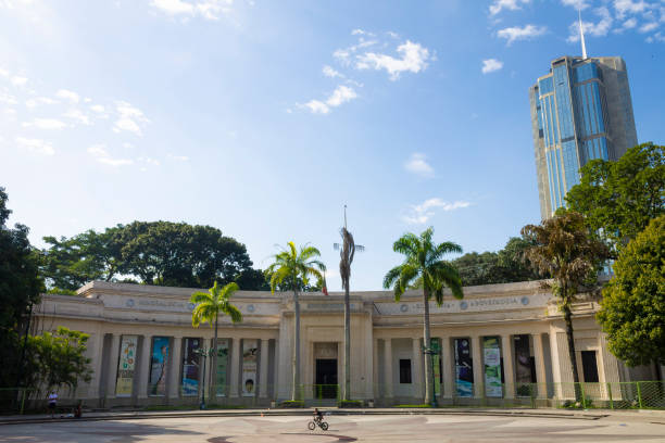
Caracas, Venezuela - Dec 24th 2014: View of the Museum of Natural Sciences of Caracas
Panoramic image of eastern Caracas city aerial view at late afternoon. Venezuela. Showing El Avila mountain also known as El Avila National Park (Guaraira Repano). Santiago de Leon de Caracas, is the capital city of Venezuela and center of the Greater Caracas Area. It is located in the northern part of the country, following the contours of the narrow Caracas Valley and the "Cordillera de la Costa". The valley is close to the Caribbean Sea, separated from the coast by a steep 2,200 m (7,200 ft) high mountain range, Cerro El Avila. To the south there are many more hills and mountains with residential constructions. Caracas is divided into five municipalities: Libertador, Chacao, Baruta, Sucre, and El Hatillo. Libertador holds many of the government buildings and is the Capital District (Distrito Capital). The Metropolitan Region of Caracas has an estimated population of 5,250.000.
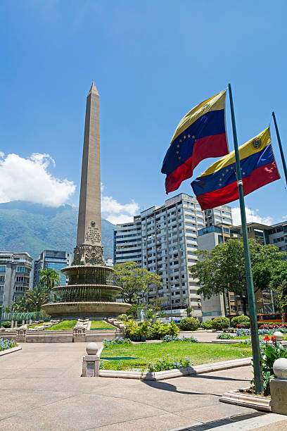
Altamira Obelisk in France Square in Caracas, Venezuela
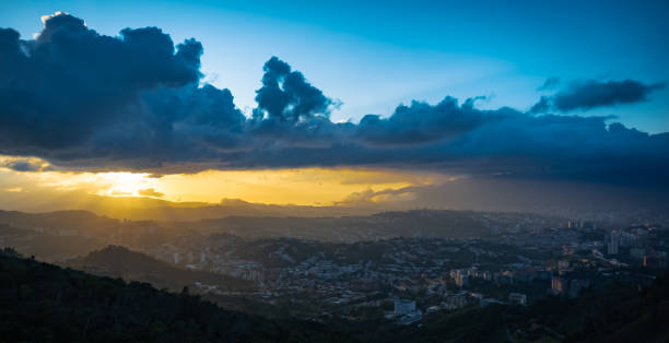
Views to the west of the city of Caracas along with a beautiful sunset that dyes the sky with orange yellow and blue tones
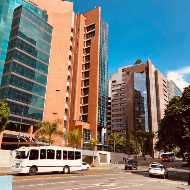
Modern building of Caracas city .
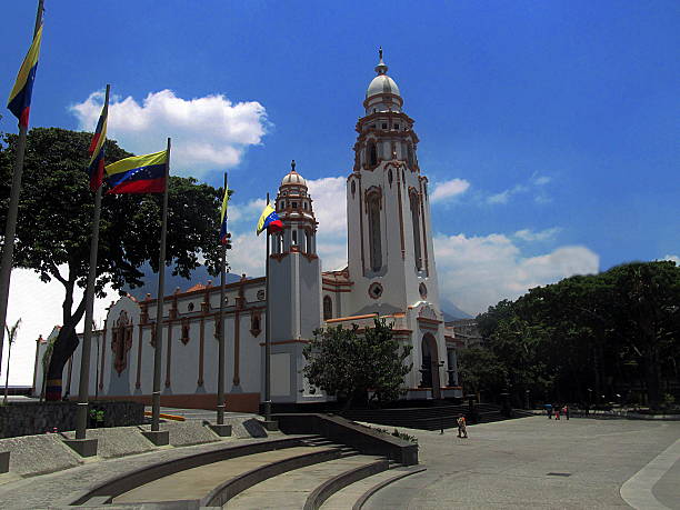
Caracas, Venezuela - April 6, 2013: Panteon Nacional de Venezuela. The shrine where heroes of the Independence War and other renowned figures of the History of Venezuela are buried including the remains of Simon Bolivar, the Liberator and main figure of the independence war that liberated Venezuela, Colombia, Ecuador, Peru and Bolivia in hte early Nineteenth Century, the latter one named after him.
View of Caracas with Avila mountain.

A panoramic view of the city of Caracas in Venezuela a country in the northern part of the South American continent with the view of the Avila mountain range in the background. Caracas is the capital city of Venezuela.
Caracas sunset with the Avila as a backdrop
Old architecture zone in Caracas, Venezuela.

Panoramic view of Caracas City at sunset from Cota Mil. Venezuela
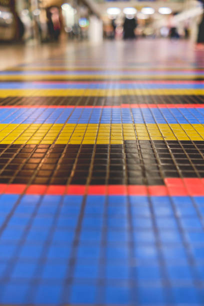
Airport floor and unrecognizable people at the international airport Simon Bolivar, Caracas Venezuela. Art by Carlos Cruz Diez.
Caracas panoramic on a sunny day, you can see the Avila Mountain and the city at its foot as well as the surrounding hills
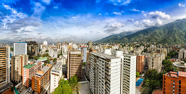
Eastern Caracas panoramic city view at Chacao Municipality. Image taken at mid afternoon with Avila mountain in the background.Cerro El Avila en el Municipio Chacao.
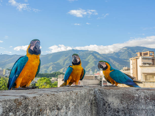
The macaws have become a typical image of this convulsed and problematic city, but these beautiful birds allow us, these moments where we can pass the switch and relax with this beautiful image. Photos in Caracas, Venezuela.
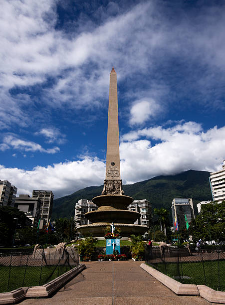
Obelisk of Plaza Francia in Caracas, Venezuela